
This website uses cookies so that we can provide you with the best user experience possible. Cookie information is stored in your browser and performs functions such as recognising you when you return to our website and helping our team to understand which sections of the website you find most interesting and useful.
Project Resilience is Disaster Relief Australia’s (DRA) nationwide multiple-phase community engagement project, aimed at increasing Australian communities’ resilience to disasters. The Project was initiated as a contribution to the Minderoo Foundation Resilient Communities Initiative, aimed at lifting Australia’s 50 most vulnerable communities to be on par with our most resilient ones by 2025. DRA’s Project Resilience continues to expand as our commitment to build resilient communities across Australia grows.
About Minderoo Foundation
Minderoo Foundation, through support from partners including Disaster Relief Australia, has launched a program to lift resilience to fire and flood risk communities across Australia by 2025. The Resilient Communities Mission provides support to communities through local programs addressing critical issues such as mental health, underinsurance, access to essential resources, education and training on resilience and leadership.
Communities that have higher levels of resilience are better equipped to cope with the impact of disasters and make plans to adapt to such events in the future. Almost half of Australia’s population live in communities that have a low-to-moderate level of disaster resilience.
Resilient Communities Mission

Leadership
Empowering local leaders to enact community resilience plans.

Knowledge
Offering new types of education and training on resilience that enable longer term change.

Resources
Improving access to critical resources before, during and after events occur to lessen impact and fast track recovery.

Investment
Accelerating new types of investments to encourage behaviour change and reduce insurance premiums.
About Project Resilience
‘Resilience’ is the ability of an individual or a system to withstand or recover from adversity, stress or challenges. It’s the capacity to bounce back, adapt, and regain functionality and well-being in the face of disruptive and difficult circumstances.
Project Resilience is DRA’s system to monitor the actual and potential disruption faced by a community. Our goal is to build a community’s ability to adapt to change, whilst maintaining their unique identity.
In a community, identity is determined by what people value about where they live. However, what a community of individual people value is open to interpretation and subject to disagreement. Rigorous, honest and challenging discussions are required to determine what a community values and how individuals can come together to support each other. Project Resilience facilitates this process to ensure that in the face of adversity, a community can rebuild.
With disasters becoming both more frequent and intense, there is significant disconnect between communities striving to prepare for disasters and their ability to access the manpower, technology or actionable information to deliver it.
Backed by the skills and experience of military veterans, emergency services specialists and an army of dedicated volunteers, DRA aims to empower these communities with projects that build disaster resilience and foster a sense of community pride.
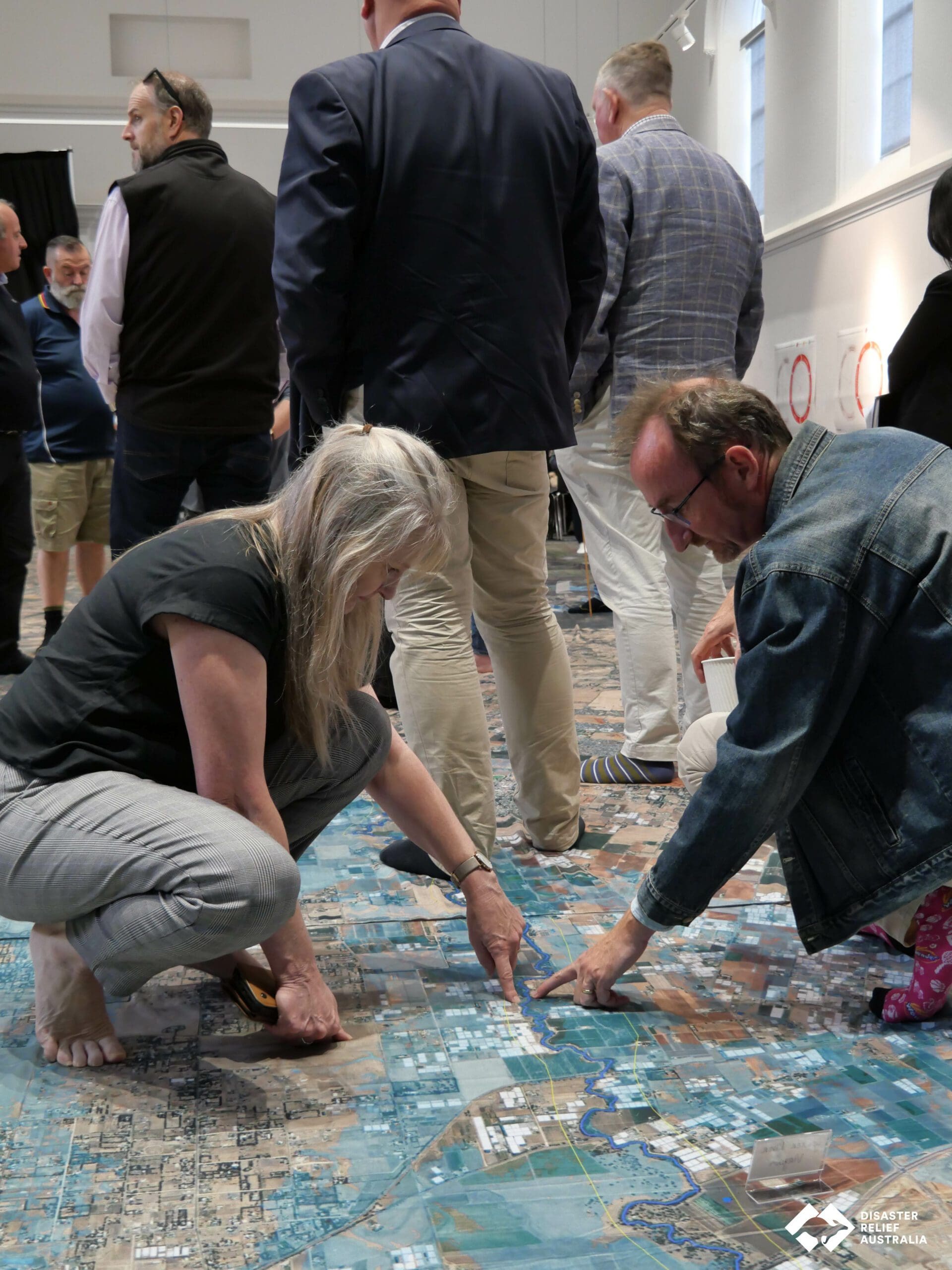
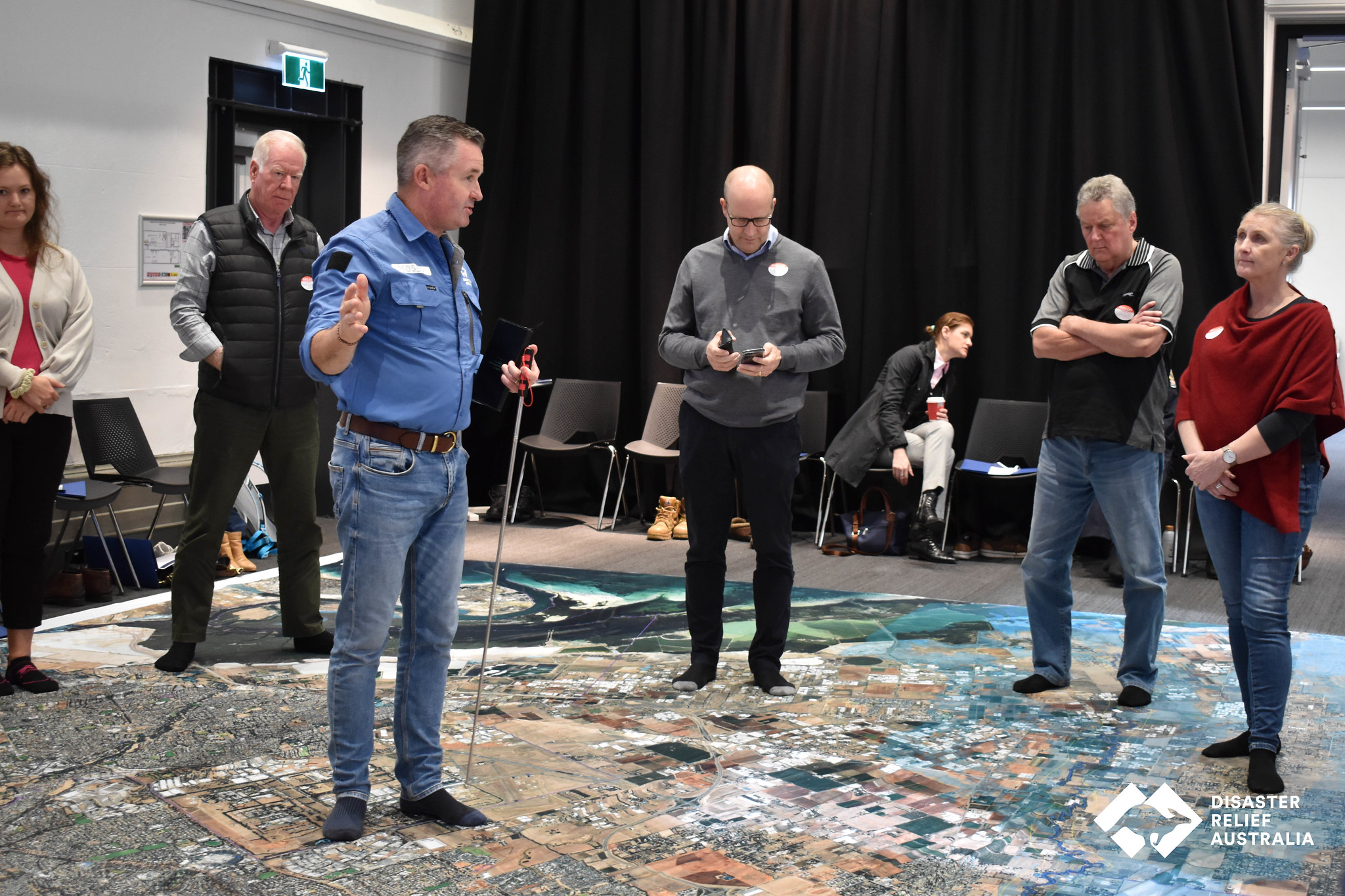
Our Big Map capability
Disaster Relief Australia utilises Big Map activity to lead and manage Project Resilience. It is a flagship capability that sits at the heart of our relief and recovery operations. By increasing our knowledge and awareness of community vulnerabilities, we strengthen our capacity to assist when required and tighten community bonds.
A Big Map exercise helps us understand a community’s complexities and develop a risk profile based on its exposure within an all-hazard environment. A ‘big map’ is created by deploying a fleet of aircraft drones piloted by trained specialists into the field to conduct post-disaster aerial operations of an impacted area. Coupled with teams of image analysts, we turn aerial imagery into maps and intelligence to highlight how a community can prepare for natural disasters in future.
Raising resilient communities
As part of Project Resilience, DRA offers a range of services to help communities mitigate risks and become better prepared.
- Aerial imagery and data mapping with our fleet of remotely piloted aircraft and trained specialists.
- Specialist assessment of infrastructure, assets, vulnerabilities and preparation priorities.
- Scenario modelling and disaster planning workshops to collect community feedback.
- Creation, management and execution of local community projects, with community collaboration.
- Training and management of local community volunteers.
- Dedicated volunteers skilled in chainsaw work, route clearance and property access, debris removal, fencing repair, expedient home repairs and more.
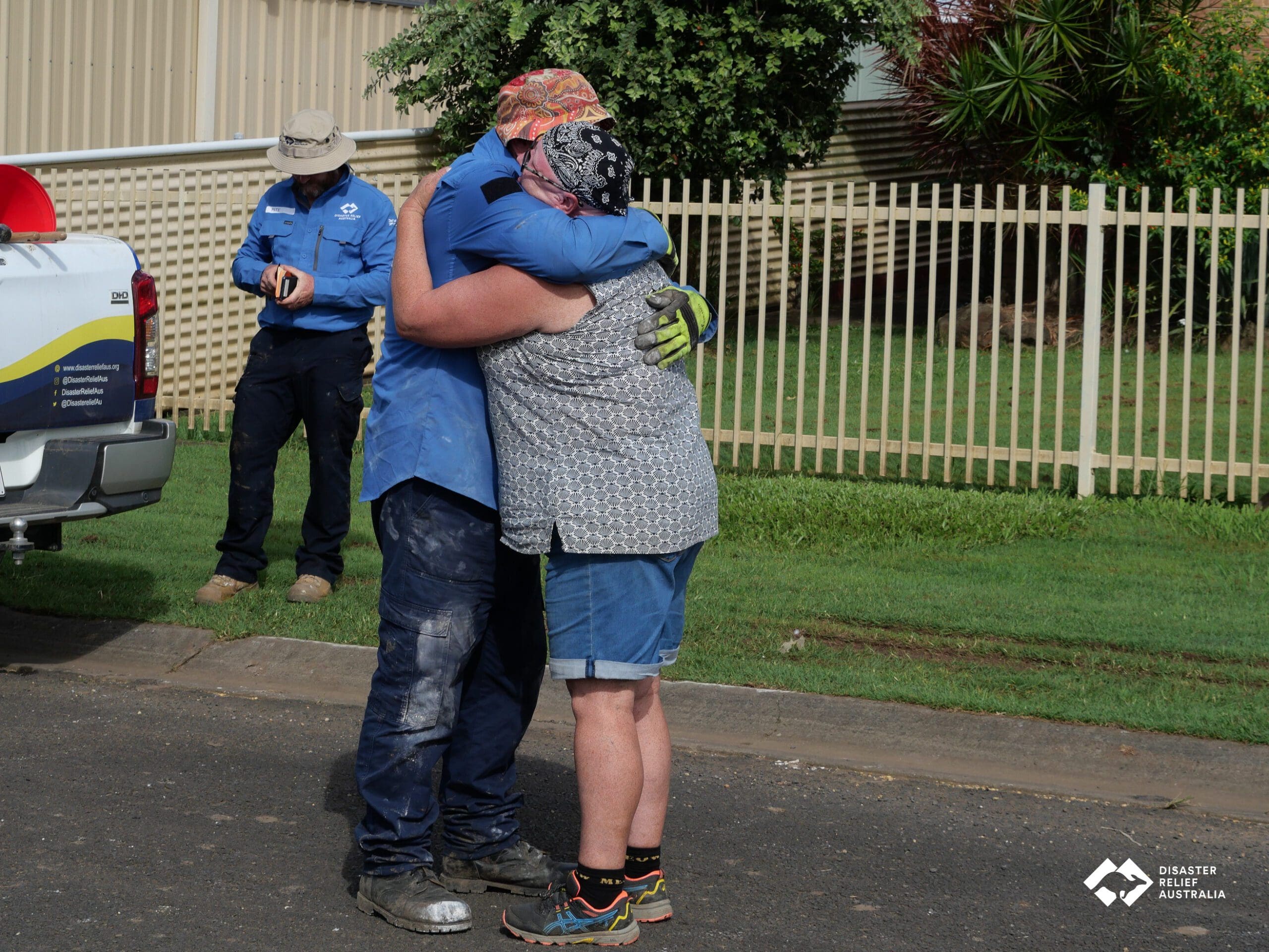
Disaster resilience volunteering
After the Black Summer Bushfires of 2019/2020, Minderoo Foundation set up an ongoing volunteering program with DRA to mobilise and deploy skilled teams of volunteers to bushfire affected regions across the East Coast of Australia. More than 850 volunteers have helped communities recover from seven extreme weather events across 74 communities.
With a recruitment program created for Project Resilience, DRA will grow the capability of first responders including military veterans, emergency management and response specialists. Outreach efforts will also raise community awareness of natural hazards, inspiring local residents to act.
By 2025, we will contribute towards a national volunteer army drawn from government, industry and the community, with 3,000 volunteers available for deployment and realising over 16,000 volunteer days of community resilience operations in four years.