BIG MAP

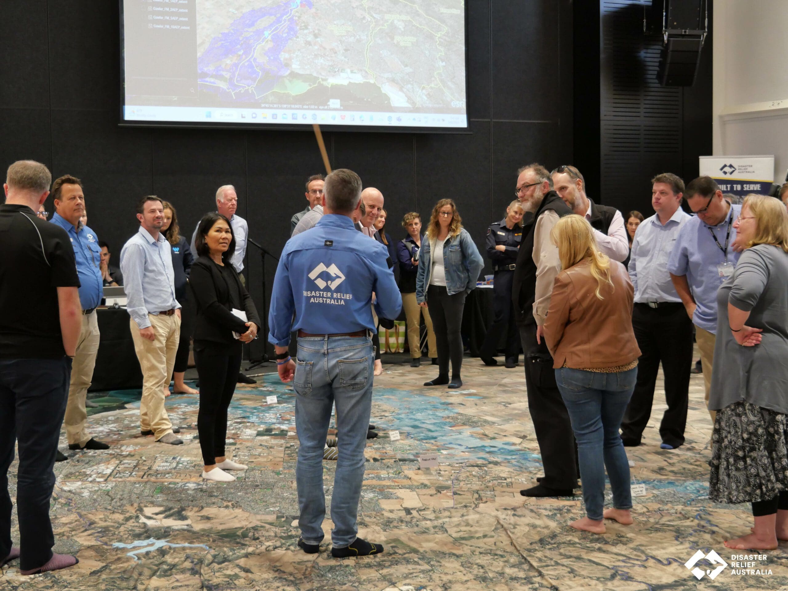
The ‘Big Map’ Capability sits at the very heart of our ‘Relief and Recovery’ operations.

We intimately understand that a community that is heard and valued is a community that is more likely to take ownership of their own relief and recovery post a disaster event.  Increasing our knowledge and awareness of community vulnerabilities, strengthening our capability and capacity to provide relief and recovery when required and tightening our community bonds are all key milestones for DRA.

At a community level, the resilience of individuals, families, or specific organisations are key components of community resilience, a resilient community is greater than the sum of its parts. Meaning that a resilient system is a complete, complex, and interconnected system which contains many more links than we can comprehend with simple cause and effect operating models

Big Map 1

Purpose of the Big Map

The purpose of the ‘Big Map’ activity is to better understand the community complexities and develop a community risk profile based on the exposure within an all-hazard environment. The past and present approach to building community resilience has been ad hoc and disjointed. No one organisation has looked to bring everyone involved together at the table to develop a collaborative approach to resilience and recovery moving forward.

Understanding, measuring, and assessing community resilience requires a keen awareness of the links and relationships between the various levels of governance and the different systems which are directly and indirectly affecting communities. Developing strategies for building and enhancing community resilience requires an understanding that vulnerability at any level translates to an increased vulnerability in other areas of the larger system.

At its foundation the DRA ‘Big Map’ links into the community where identity is always essentially by what people value and about where they live. However, what a community of people collectively values are open to interpretation and subject to disagreement. This suggests that people and the ways they come to a rough consensus—are necessarily at the very centre of community resilience and their intended future.

Big Map 2
Big Map 3

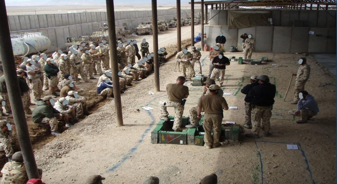
From the battlefield to the boardroom

For many DRA members, these forms of community lead discussions and forums are essentially second nature due to their previous operational experience and previously highly trained ability to assimilate risk and operational effectiveness when on a battlefield. The ‘Operational Big Map’ is based on a military wargame theory, therefore the purpose of using wargaming models is not to emulate reality, but to serve as a device for stimulating innovative thought.

Empowering the community

Building resilient communities in the context of a disaster event integrates prevention, preparation, response, and recovery in a complex and continuous process, rather than a process with a definitive end point or ‘destination’.

As an emerging area of culture and practice, DRA is leading the way in understanding, working with and empowering community lead discussions and community-based forums.

DRA is a veteran-led not-for-profit that unites the skills and experience of Australian Defence Force veterans with emergency service specialists to rapidly deploy volunteer disaster relief teams in Australia and around the world in the wake of disasters. DRA’s ‘Big Map’ is a flagship capability that sits at the very heart of their relief and recovery operations.

Big Map 4

The Pillars of Recovery

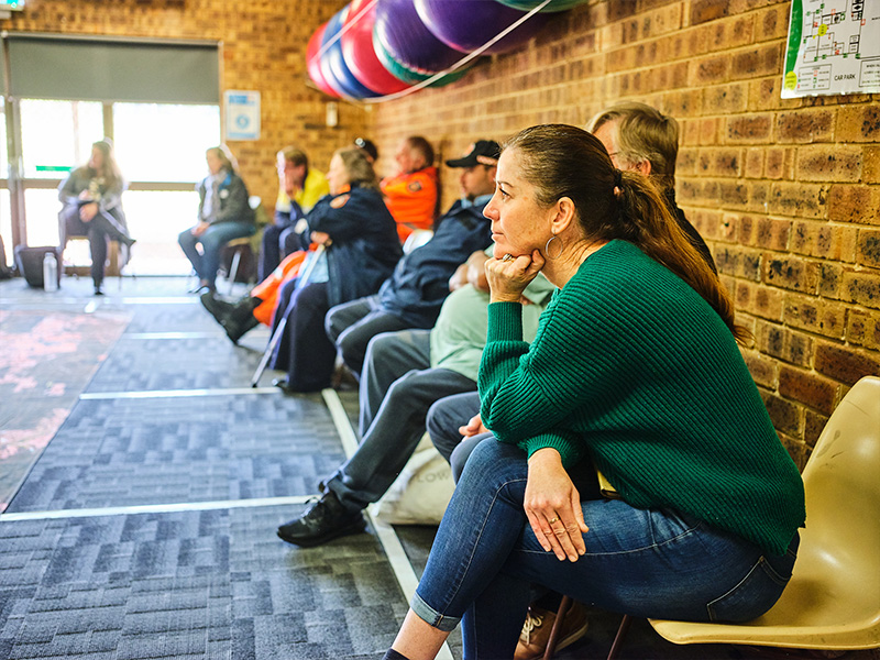
Post a disaster event the community will naturally come together to support one another after as required. Strong, connected communities are better prepared to respond to and recover from disasters when they occur. In a major emergency, official responders will always need to prioritise the most urgent issues, so it is likely that for the first few days the community will need to help each other within the disaster. The Community Core is a designated community group where people can gather, connect with one another, and solve problems using the skills and resources that already exist among their community.

Human and Social

This relates to the emotional, social, physical, and psychological health and well-being of individuals, families and communities following a disaster. The Human and Social pillar within a Communiyt Core aims to:

  • Gain access to timely information from the Local Government,
  • Aids in providing assistance to reconnect with families, friends and community networks,
  • Enables community members to manage their own recovery through access to information and the knowledge of where to find Local, Regional and State services and/or practical assistance, including financial assistance for those individuals and households who are most vulnerable and do not have the means to finance their own recovery.
  • Acts as the lead for the community and the vital link between Local Government and the community to access emotional, psychological, and mental health support at individual, family, and community levels (psychosocial support).

Tasks include:

  • Identify and select a Community Core leader
  • Identify a suitable location and secondary location to act as a community core / community centre immediately post a disaster event
  • Understand the roles and responsibilities of the Red Cross, Vinnies, Disaster Relief Australia, other Community Groups, GIVIT, State and Federal Recovery and Funding Arrangements, and Local Government Relief and Recovery arrangements.
  • Understand and identify the location of the critical care members of the Community, and
  • Lead and interpret the needs and requirements of the community when outside assistance arrives.
Economic

The effects of a disaster on the economic environment can be classified in terms of direct and indirect impacts. The tangible impacts can usually be given a monetary value and may include loss of tourism, employment opportunities and reduction in cash flow for businesses. Each community has a business lead and chamber of commerce established. A community member from these groups is always very well connected and fully understands the community in which they live. A Community Core with this type of leading community member is always a great asset to have.

Tasks include:

  • Identify and understand the key economic drivers of the community. What’s unique to this community and if its impacted how will this impact the community over the next 3, 6 months if lost or damaged?
  • Understand the State and Federal Recovery and Funding Arrangements.
Environmental

Impacts to the environment may include damage or loss of flora and fauna, poor air quality, reduced water quality, land degradation and contamination, or damage to heritage listed places. A representative from the community who understands these impacts and is willing to step forward and guide the Local Government as required.

Tasks include:

  • Identify and understand the environmental impacts across the community
  • What do these impacts have on farming, businesses and or private landowners?
  • Understand localised flood mitigation options, bushfire mitigation strategies etc
Building

The effects of a disaster on the built environment often result in damage and disruption which inhibits the capacity of essential services and services such as housing, accommodation, education, and health facilities. A representative from the community (local builder, plumber etc) who understands these impacts and is willing to step forward and guide the Local Government as required.

Tasks include:

  • What has been damaged or impacted in the community (Minor, Moderate Major).
  • Are there likely to be insurance issues?
  • Will outside contractors impact the community if utilised?
  • What building capabilities exists within the community?
Roads and Transport

The effects of a disaster on transport networks, including road, rail, aviation and maritime normally result in difficulty accessing communities and disruption to critical supply chains (both within and outside of the impacted area). Restoration of these networks, or the identification of alternatives, is a priority in disaster recovery. A representative from the community who understands these impacts and is willing to step forward and guide the Local Government as required.

Tasks include:

  • What local roads, bridges and or access routes have been impacted?
  • What is the result of these impacts (can’t access property, roads damaged, bridges damaged etc)?
Big Map 5
Big Map 6
Big Map 7

Our Operational Products ‘Big Map’ Capability

Increasing our knowledge and awareness of community vulnerabilities, strengthening our capability and capacity to provide relief when required and tightening our community bonds are all key to DRA and the DRA Resilience Process. As an emerging area of culture and practice, DRA is leading the way in understanding, working with and empowering community lead discussions and community-based forums. For many DRA members, these forms of community lead discussions and forums are essentially second nature due to their previous operational experience within the Australian Defence Force and previously highly trained ability to assimilate risk and operational effectiveness on a battlefield. As an example, the large map discussion is based on a military wargame theory, therefore the purpose of using wargaming models is not to emulate reality, but to serve as a device for stimulating innovative thought.

Big Map 8
Big Map 9

Willawarrin, NSW 22nd Apr 2022

Willawarrin is a small New South Wales Rural Location within the local government area of Kempsey, it is located approximately 353kms from the capital Sydney covering an area of 25.37 square kilometres. Willawarrin has a recorded population of 191 residents and is within the Australian Eastern Daylight Time zone Australia/Sydney.

Read more

Purpose: The purpose of the Willawarrin (Flood and Fire) Resilience Strategy was to better understand the community complexities and develop a community risk profile based on the exposure from flood and fire that leads to vulnerabilities and community risk. By understanding how, when and where this region is impacted by fire and flood is vital to those who live here. Not just for safety, but for protecting livelihoods, property, and people. Businesses operating within the region also need to know how it works to make risk-informed investment and operational decisions in line with future Local Council objectives. Endstate: Over the past three years, Willawarrin has been devastated by fire and flood. Willawarrin was chosen for this exercise because your community was passionate about building a local resilience plan, but did not yet have the manpower, technology, or actionable information, to deliver it.
Big Map 10

Mogo, NSW 17 June 2022

Mogo is a small heritage town in the South Coast region of the state of New South Wales, Australia. Mogo is administered by the Eurobodalla Shire council. The town is located on the Princes Highway (Highway 1), south of Batemans Bay and north of Moruya. At the 202 census, Mogo had a population of 332 consisting of 73 families across 13 private dwellings.

Read more

Purpose: The MOGO Community accepts that flooding is an inevitable natural process, which in many circumstances is beneficial for fisheries agriculture, ecosystems and water storages. Resilience and mitigation activities do not eliminate the risk of flood. Endstate: DRA conducted a ‘big map’ scenario model and disaster planning workshop to collect community feedback. This assisted DRA to overlay the community’s vital local knowledge with aerial imagery and data mapping technology, empowering the community and its leaders to proactively reduce disaster risk and identify local solutions to help improve resilience over time.
Big Map 11

Collie, WA 5th August 2022

The Shire of Collie is an inner regional area of Western Australia (WA), known for its coal industry and coal fired power stations. Its population and dwellings are substantially below the median in terms of age, education, dwelling resilience and socio-economic disadvantage. Collie enjoys a socially cohesive and engaged community, although is facing economic challenges with future transformation into new energy and manufacturing hub.

Read more

Purpose: Collie has been impacted historically by flood including a major event in 1963 and several localised flooding events continue to impact the town and nearby Allanson in 2012 and 2017. Floods resulted in blocked roads, threats to access to shopping precincts, risk of rail line flood, and some emergency services sites are at risk (SES). In mid-June 2022, the State Govt announced 2030 as the end of state coal mines in Collie and the end of coal-fired power supply. It is supporting new industry development for green energy, plus promoting manufacturing in Collie including: a new emergency driving training school/ a $47.5M Govt contract to Technifire to build up to 300 new firefighting vehicles (40% of body assembly work in Collie by Piavanini Welding). Endstate: At the end of the workshop the Collie Local Emergency Management Coordinator (LEMC) and local community will have a better understanding of local flood hazards, be better prepared for flood planning with additional inputs into the flood section of the Local Emergency Management Plan (LEMP), and have completed flood mitigation activities in conjunction with DRA as part of Project Resilience.
Big Map 12

Richmond Catchment, Northern Rivers NSW 9th & 10 Sep 2022

The past and present approach to flood risk management in NSW has been to develop Flood Risk Management Plans (FRMPs) for targeted urban villages and towns located on
floodplains. FRMPs are usually funded jointly through Local and State Government programs and are often based on individual council’s need and available budget at the time.

Read more

The past and present approach to flood risk management in NSW has been to develop Flood Risk Management Plans (FRMPs) for targeted urban villages and towns located on floodplains. FRMPs are usually funded jointly through Local and State Government programs and are often based on individual council’s need and available budget at the time. In our experience, based on our previous flood resilience projects A common issue to most parts of Australia is the inadequate use of flood mapping in an operational context. During flood emergencies, response agencies often default to local knowledge of past flood behavior, rather than make use of the information available from Flood Studies and or Flood Risk Management Studies. A factor which could contribute to this issue is the numerous, and sometimes conflicting, studies available for a single catchment. Further, a collection of localised flood models has limited use for flood warning purposes. Response agencies require an overview of the complete hydrologic system, rather than having to waste time making interpretations between separate sources of information. The DRA Richmond River Catchment ‘Big Map’ exercise will do exactly that.
Richmond Catchment Report 2023
Big Map 13

Gawler River Catchment, Adelaide Plains, SA

The Big Map activity identified that agri-business, horticultural activities, and residential land development is increasing in the Adelaide Plains and, accordingly, so is the risk of damage and/or destruction during flood events. Although no homes were damaged when the Gawler River broke its banks in November 2005, around $40 million worth of crops were lost and there was significant damage to public infrastructure.

Read more

Most recently, the Gawler River catchment experienced significant rainfall between late September and early October 2016. Falls ranged typically between 100 to 140 mm in the upper North and South Para River catchments, and this resulted in a major flood event in the lower reaches of the Gawler River, with an estimated ARI of 20 years.
Read the Gawler Catchment Report 2023
Big Map 14

Bega, New South Wales 16th March 2023

Understanding Fire, Sponsored by Australian Business Volunteers (ABV)

Big Map 15

Snowy Mountains, NSW 23 June 2023

Upcoming events

Forbes, New South Wales

12th August 2023

Potential funding has been made available.


Murray, Western Australia

Date to be confirmed. 

Potential funding has been made available.


The Macleay Catchment, New South Wales

28th July 2023

Potential funding has been made available.


Darwin, Northern Territory

Date to be confirmed. 

Potential funding has been made available.